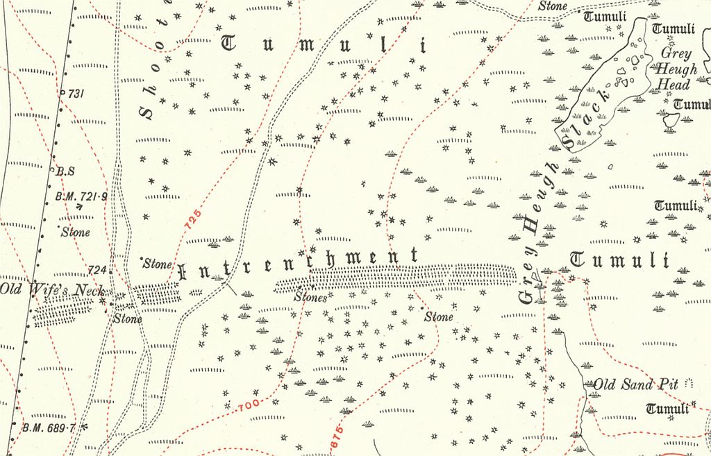
A couple of previous posts have looked at the Old Wife’s Neck standing stone, which stands on the Bronze Age earthworks on John Cross Rigg – an area of moorland 5 miles south of Whitby. The old OS maps show the 780m long earthworks running in an east-west line across the moor, but in addition to this, the maps also mark hundreds of small tumuli on the north and south sides of these ancient banks and ditches. The OS maps record similar groups of tumuli at other prehistoric sites on the North York Moors, and these are usually small piles of stones known as clearance cairns. Previous visits to John Cross Rigg had only noted a few of these cairns, and so it was assumed that the blanket heather was covering most of the other mounds. (The more detailed 25″ OS map from 1893 actually plots around 1300 tumuli in total, with 850 to the north of the earthworks, and 450 on the south side.)
The 2025 Langdale Forest fire spread onto John Cross Rigg and burned off most of the heather on the moor. When it was safe to return to the area it was something of a shock to see the bare moorland, and at the same time quite puzzling that there were no sign of the hundreds of tumuli marked on the old maps. Where were they? Had the OS map surveyors mistakenly marked hundreds of mounds in this area? Or had the tumuli been removed some how in the years after the maps were published?
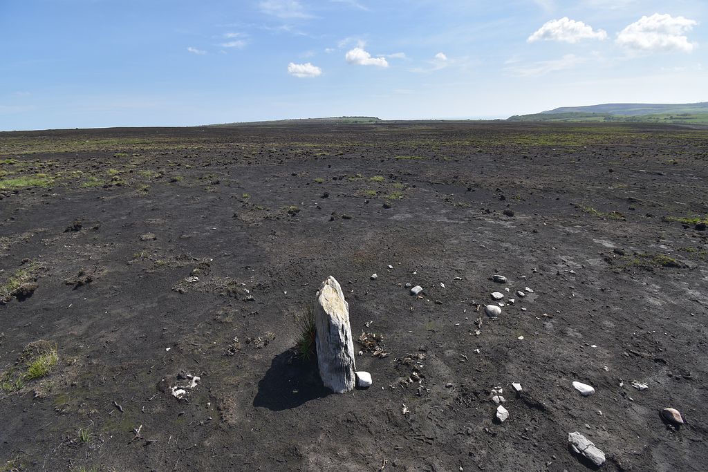
Even before the 2025 fire, the archaeologist Blaise Vyner had referred to the ‘mythology’ that had grown up regarding these tumuli – with questions as to their actual number, if some had been damaged or removed, and even if they really existed in the first place (Vyner, 2021). The first edition OS map surveyed in 1848 does not mark any tumuli on the moor, while the more detailed 25″ map surveyed in 1891 noted over 1000 tumuli. This suggests that more favourable conditions existed on the moor at the later date (most likely with the heather burnt off) allowing the surveyors to mark numerous low mounds that had previously been obscured.
Fourty years after the 25″ map was surveyed, Frank Elgee visited the moor to investigate the prehistoric remains there, but he noted that the tumuli were “not easily seen; in fact they are by no means as conspicuous as those on Danby Rigg”, and he suspected that many had already been removed. This again suggests that the tumuli were small and easily hidden beneath vegetation. If these tumuli were in fact cairns then it is not impossible that a large number had been removed in the 40 years after the OS surveyed the moor, as the numerous piles of stones would make a useful ‘quarry’, ready to be carted away for walling or road surfaces etc.
Send in the army
Ten years after Elgee’s visit, John Cross Rigg and the surrounding moorland became part of a large area taken over by the Ministry of Defence during WW2. MOD maps show that John Cross Rigg was part of an area used for live fire battle training, while aerial photographs from the time show many deep trackways made by tanks and other heavy vehicles running across the moorland and through gaps in the earthworks.
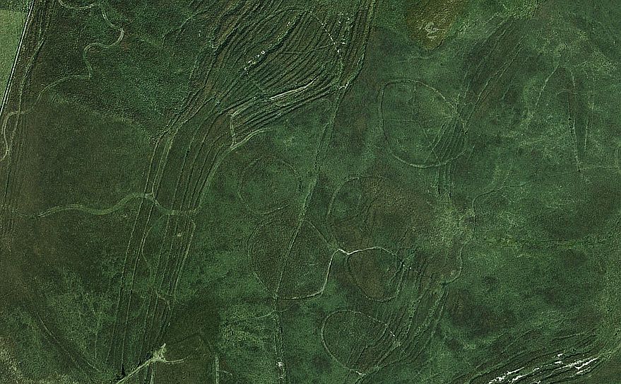
The MOD also used the area to the north of the earthworks as a ‘decoy site’, where large, roughly circular enclosures were created, and equipment installed within them in an attempt to trick German bombers into thinking they were over Middlesbrough (Dennison, 2023). Patterns of lights were setup to mimic Middlesbrough streets, while other devices burnt fuel to simulate buildings set on fire by incendiary bombs. The whole purpose of the site was to trick the Luftwaffe into dropping their bombs on the moors rather than Middlesbrough’s industrial areas. These enclosures and installations would require the ground to be prepared, with the heather removed, and any obstructions cleared away to provide access. In this situation the moor may also have been burnt off to prevent the decoy fires spreading to the surrounding land.
With the MOD planning to use this whole moor as a training ground and decoy site, it is possible that the Royal Engineers were called in to prepare the area in advance using heavy machinery to clear the land. Some support for this comes from Blaise Vyner’s work on the cross ridge boundary earthworks on the North York Moors. His investigations of the earthworks on John Cross Rigg revealed that a long stone row originally ran along one section of the ditch and bank, but these large stones appear to have been winched up out of their sockets by a heavy tracked vehicle in the recent past. Locally this was said to have taken place during the second world war. So it appears that the army did have heavy equipment on the moor removing obstacles, and perhaps many of the tumuli were also cleared away as part of the same process.
Time for a little tumuli spotting
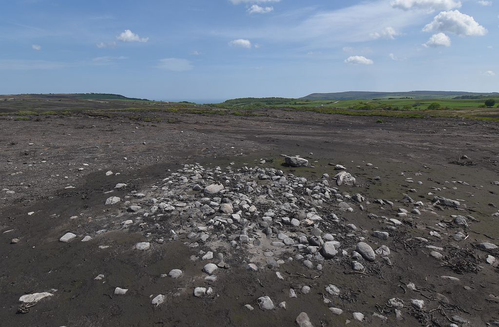
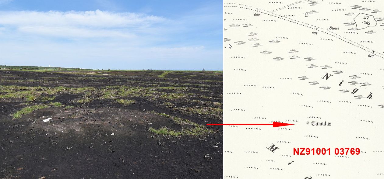
It was originally assumed that all the tumuli marked on the OS map would be small stone cairns, and walking over the burnt moor in May and June 2026 did identify a number of cairns, whose location tallied with the position of tumuli marked on the OS map (as did the location of several small standing stones). So the OS surveyors were accurate, it’s just that hundreds of other mounds they marked on their map seem to be no longer visible.
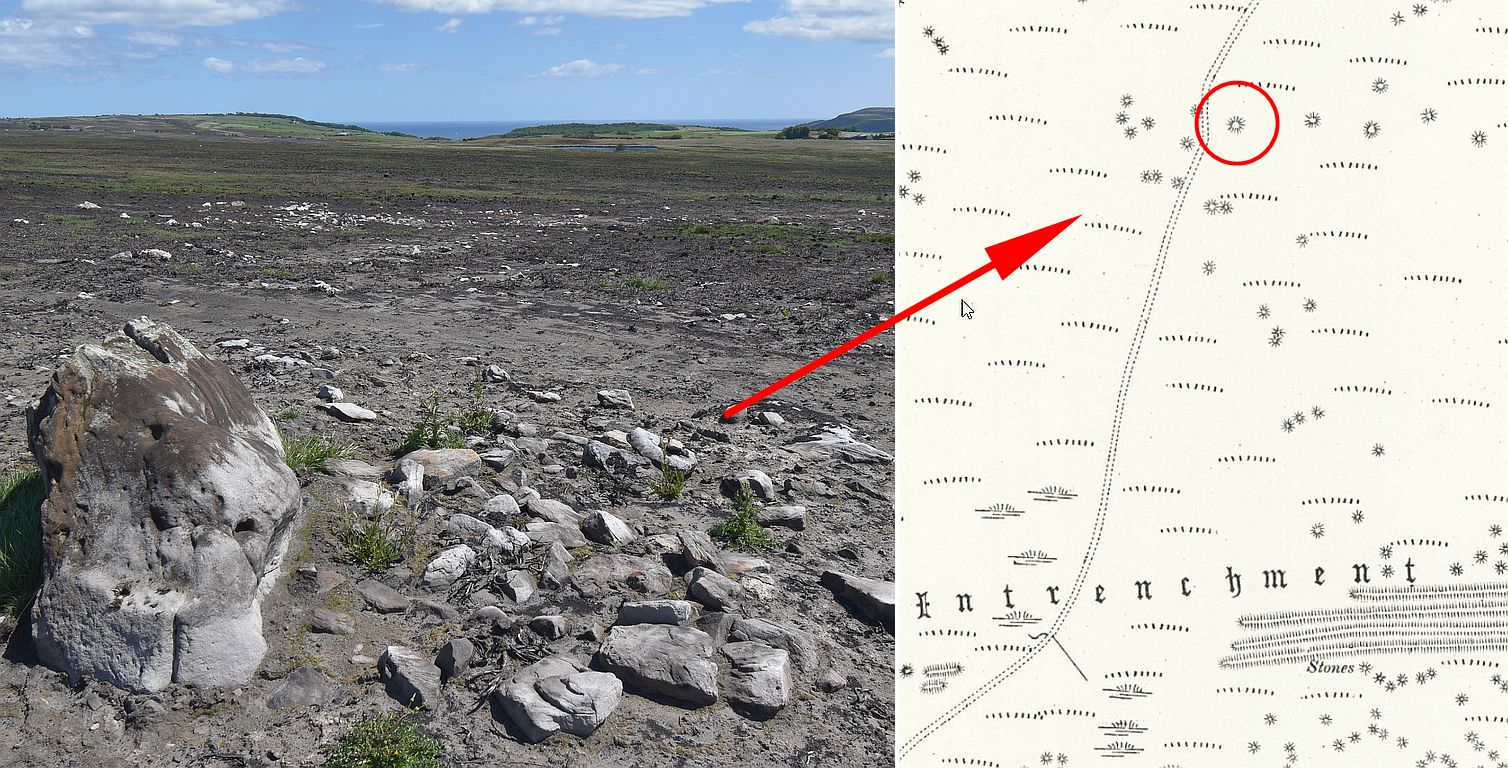
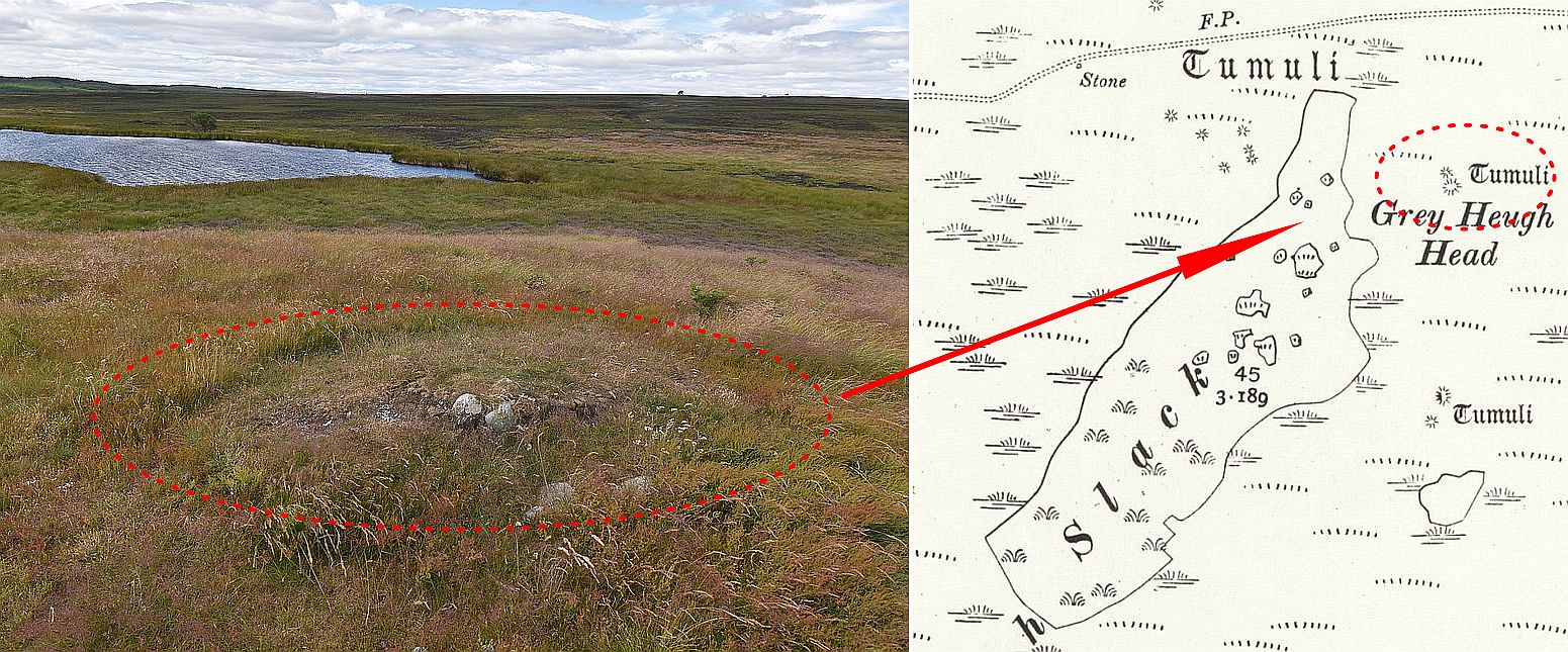
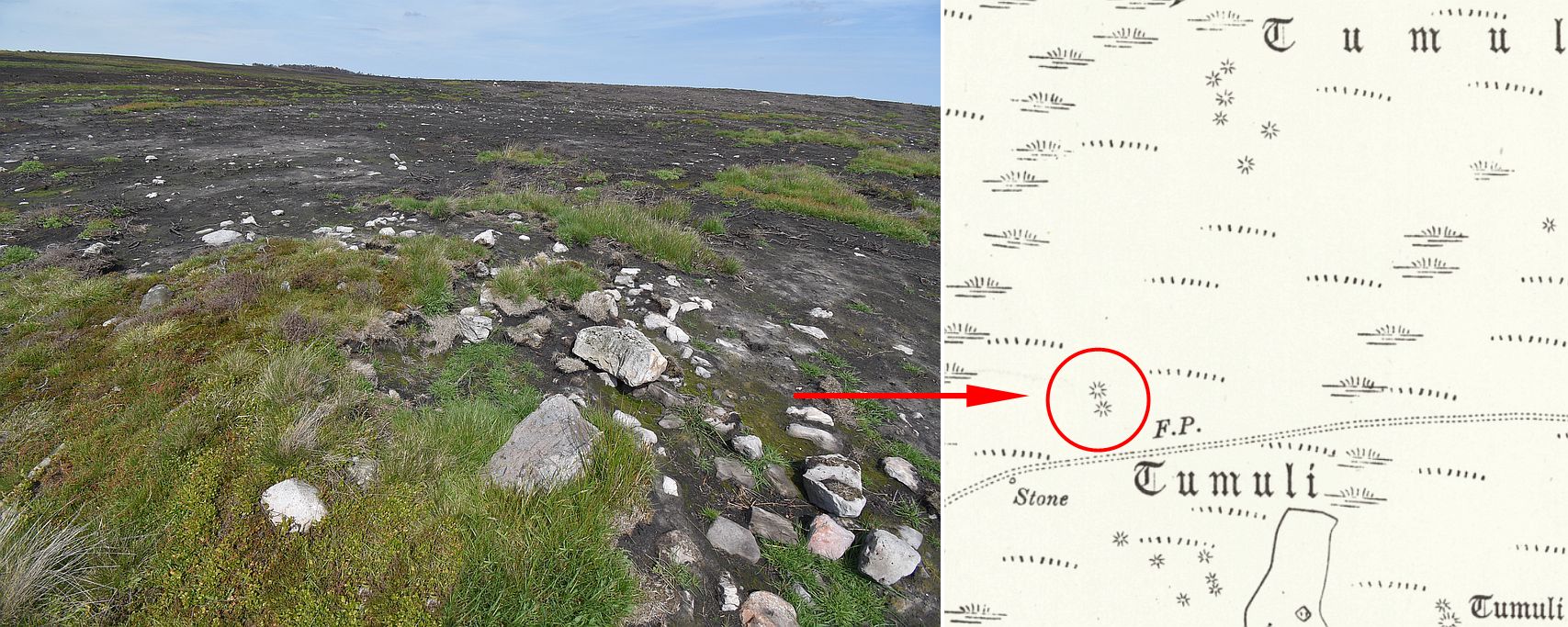
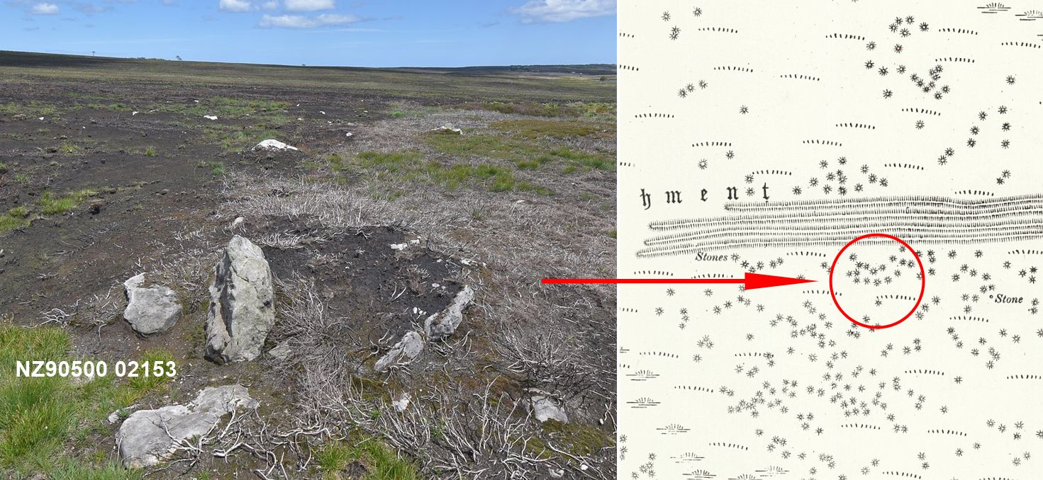
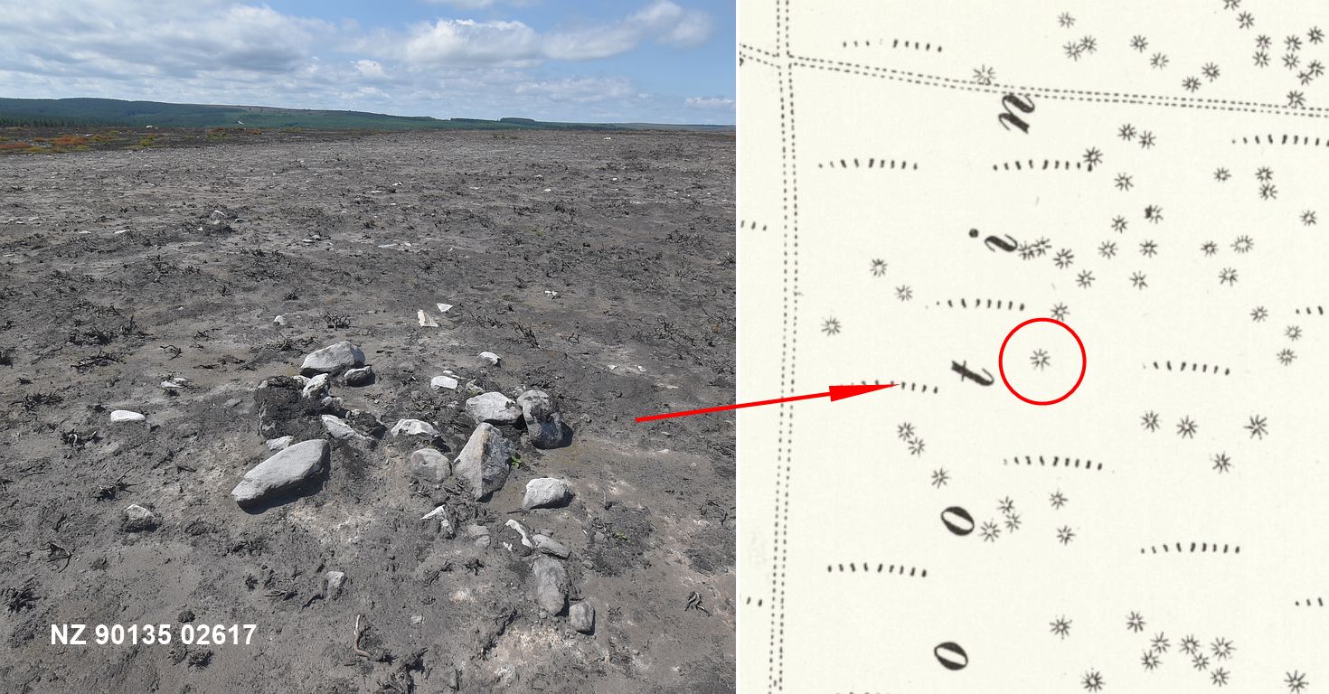
One thing that is noticeable on different parts of the burnt moor is how ‘clean’ and even the surface is. This is probably natural – but it gives the impression that the surface has been cleared and some how smoothed over. There are also large areas where the peat layer beneath the heather has also burnt away, and this has revealed the old land surface. Some of these exposed areas are literally covered in stones, and it is hard not to wonder if these are the remains of cairns, but it is equally hard to imagine how the stones from the cairns could have been levelled and spread across such large areas under the peat.
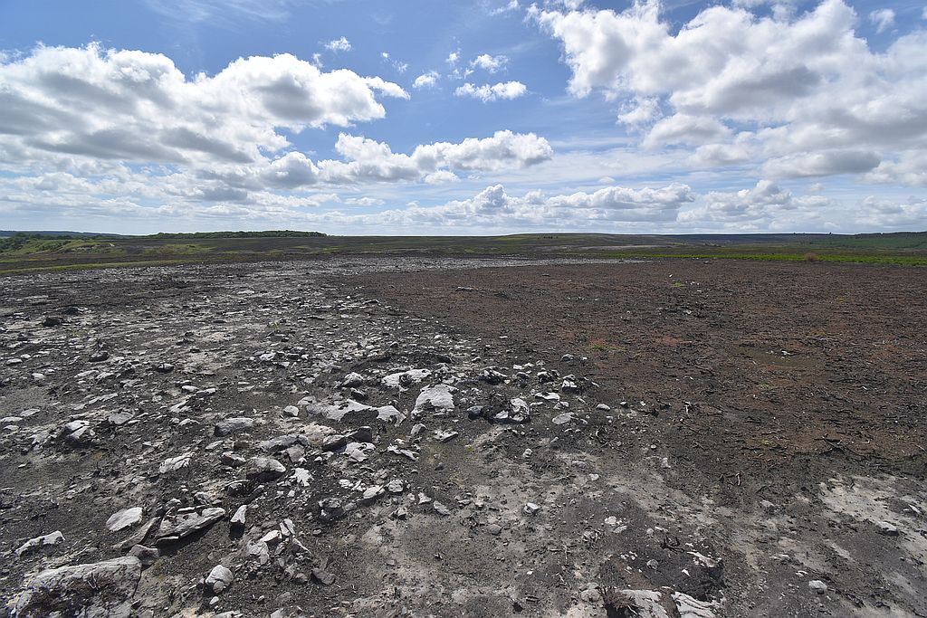
So a few cairns can still be seen on the moorland, but where are the rest of the ‘Tumuli’? It seems highly unlikely that the Ordnance survey would accurately plot hundreds of mounds that did not exist, whilst the remains of some cairns and the small standing stones at the locations marked on the map does support their survey work on the moor. So the perhaps the real question is – were all the ‘tumuli’ they plotted actually cairns? A walk around the moor suggests that this was not the case.
Technically Tumuli ?
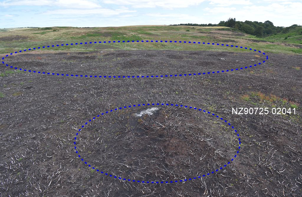
Using a handheld GPS to check the locations of around 100 tumuli marked on the OS map did reveal a number of cairns, but it also revealed that the OS surveyors appear to have plotted the position of hundreds of small and low mounds of earth measuring only a metre or two in diameter and only 30cm or so in height.
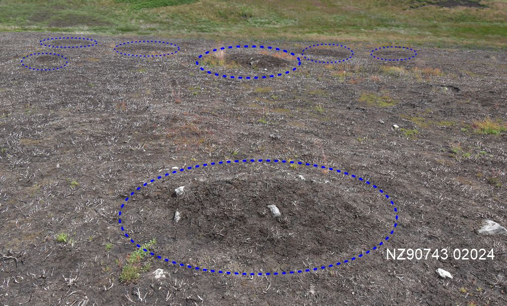
Many of these mounds are so low and indistinct that they are barely noticeable – ‘not easily seen’ as Elgee noted 100 years ago. A few are more prominent – being a little larger, or elongated in shape, or including a few stones, which makes them more noticeable, but generally they could easily be dismissed as just bumps in the ground.
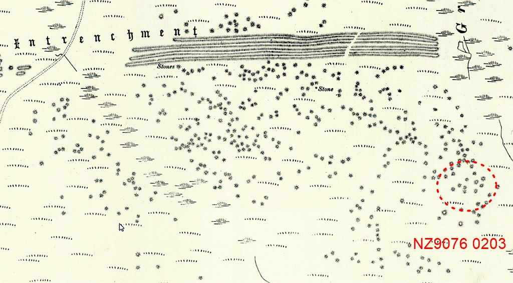
A large enough group of these earthen mounds survive in the area to the south east of the earthworks, and this makes it possible to see what the OS Surveyors were actually recording as ‘tumuli’ on their map. This cluster of small mounds closely match the positions of the tumuli recorded by the OS at this location, and once identified it becomes easier to spot more examples of these mounds in other areas.
The Mystery solved?
Perhaps. It has generally been assumed that the hundreds of tumuli marked on the OS map would be cairns of stones, but this has proved not to be the case. Instead most of the ‘tumuli’ appear to be small and rather insignificant mounds of earth. It also appears that some of them are no longer visible – as Frank Elgee noted back in the 1920’s. One explanation is that the low and indistinct nature of these mounds means that they can very easily be overlooked, or hidden by vegetation. Indeed, many appear as just low ‘bumps’ of earth that can easily be passed by unless specifically looked for. And yet it is these groups of low earthen mounds which tally with the locations of the tumuli groups marked on the OS map.
The Tumuli seem to survive best along the east and west edges of the moor – away from the military areas, tank tracks, and the various routes taken by the old Robin Hoods Bay road over the years. Being small mounds of earth rather than stones would makes them more susceptible to erosion and damage, so perhaps the traffic and other activity in these areas has destroyed some of these indistinct features?
The next obvious question is – are these small earthen mounds natural or man made? Individually they could be dismissed as natural bumps in the land surface, but their sheer number and grouping together around the earthworks might suggest human activity. However, there may well be some geological explanation for the clusters of small mounds (and the stone covered land surface noted in other areas), but this needs a expert’s eye.
Now that the moorland is burnt off, It is quite likely that an archaeological survey will take place, and this may finally reveal the truth behind the tumuli.
After notes
If these small mounds of earth are the tumuli noted during the 1891 survey, then for them to be visible at that time suggests that the moor was burnt off to a similar degree as it is now in 2026.
There is also the question as to why would the OS surveyors record such insignificant mounds? Perhaps the huge number and their grouping together did not look natural to them and they assumed some connection with the earthworks.
References
Dennison, E. (2023) Archaeological Survey, Low Moor, QL bombing Decoy. (PDF here)
Elgee, F. (1991) A man of the Moors – Extracts from the Diaries and letters of Frank Elgee.
Vyner, B. (2021) Cross Ridge Boundaries on Fylingdales Moor Prehistoric Yorkshire Vol 58 (online here)

